Overview
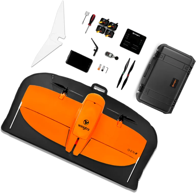
WingtraOne GEN II is a professional VTOL (Vertical Take-Off and Landing) fixed-wing mapping drone designed for survey-grade accuracy and large-area coverage. It features a tailsitter design for vertical takeoff and landing combined with efficient fixed-wing flight. The drone supports multiple payloads including high-resolution RGB cameras (MAP61, RGB61, Sony a6100), multispectral (MicaSense RedEdge-P), and a LIDAR sensor. It achieves consistent 3 cm (0.1 ft) absolute accuracy with built-in PPK GNSS, covers up to 460 ha per flight with the MAP61 sensor, and has a maximum flight time of 59 minutes. WingtraOne is NDAA compliant, Green UAS certified, and carries EASA C3 certification, making it suitable for commercial surveying, mapping, inspection, and agriculture applications globally.
Detailed specifications
Sensors6
- Gsd Minimum Rgb61
- 0.7 cm/px (0.28 in/px)
- Lidar Point Density Hard Surface 90m
- 110 pts/m2
- Lidar Point Density Low Vegetation 90m
- 220 pts/m2
- Lidar Point Density High Vegetation 90m
- 330 pts/m2
- Maximum Coverage Lidar 90m 30pct Overlap
- 360 ha (890 ac)
- Maximum Coverage Photogrammetry 120m 60pct Overlap
- 460 ha (1140 ac)
Other7
- Flight Speed
- 16 m/s (35.8 mph)
- Tablet Model
- Samsung Galaxy Tab Active 3 (MIL-STD-810, water/dust resistant)
- Max Wind Gusts
- 18 m/s (40 mph)
- Included Accessories
- 1x carrying sleeve, 1x pilot box, 1x tablet with WingtraPilot, 1x telemetry module, 2x battery pairs, 1x charging station, 1x anemometer, 1x micro SD card reader, 1x side stands, 1x middle stand, Torx tools
- Ground Wind Resistance
- 8 m/s (19 mph)
- Max Wind Resistance Sustained
- 12 m/s (27 mph)
- Max Altitude High Alt Propellers
- 5000 m (16,400 ft) AMSL
Reviews for WingtraOne GEN II
Loading reviews…